Statues - Hither & Thither |
Site Search:
|
|
Vreden
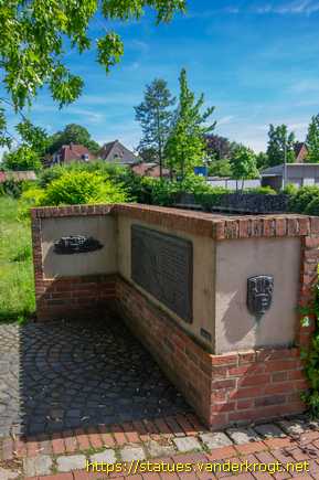
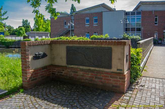
(Stadt Vreden) Kr. Borken Nordrhein-Westfalen Butenwall |
Die Berkel verbindet die Niederlande und DeutschlandThe Berkel connects the Netherlands and Germany |
Otto Breuing
1989 |
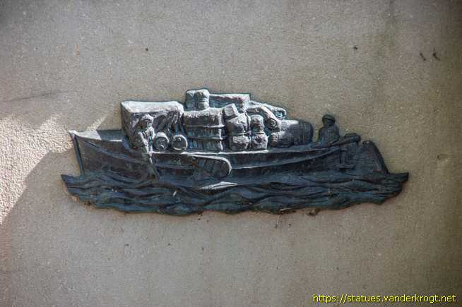
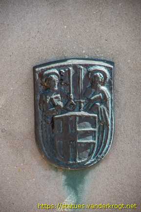
Plakette mit einer Karte des Flussverlaufs der Berkel von der Quelle bei Billerbeck bis zur Mündung in die IJssel bei Zutphen. Links davon ein Relief eines voll beladenen Berkel-Lastkahns und rechts das Wappen von Vreden.
A plaque featuring a map showing the course of the River Berkel from its source near Billerbeck to its confluence with the River IJssel at Zutphen. To the left is a relief depicting a fully laden Berkel barge, and to the right is the coat of arms of Vreden.
|
|
|
|
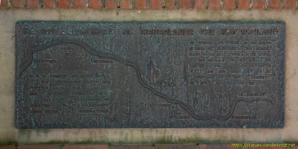
| DIE BERKEL VERBINDET DIE NIEDERLANDE UND DEUTSCHLAND | |
|
im 13. jh. standort der berkelmühle 1810 · übernahme durch den fürsten salm-salm. 1896 1. stromlieferung ins netz. 1945 · durch kriegseinwirkung zerstört. 1954 · vew* modernisiert durch einbau von 2 generatoren. |
die berkel entspringt in den baum- bergen bei billerbeck und mündet nach 110 km bei zutphen in die ijssel das gefälle von der quelle bis vreden ca. 89 m von der mitte des 17. bis zum ende des 19. jh. fuhren auf ihr schiffe (zompen) die 7 bis 8t laden konnten. |
| THE BERKEL CONNECTS THE NETHERLANDS AND GERMANY | |
|
In the 13th century, site of the Berkel Mill 1810 · Taken over by the Prince of Salm-Salm. 1896 · First electricity supplied to the grid. 1945 · Destroyed during the war. 1954 · VEW* Power station modernised with the installation of two generators. |
The Berkel rises in the Baum- bergen near Billerbeck and flows into the IJssel near Zutphen after 110 km The drop from the source to Vreden is approx. 89 m From the mid- 17th century to the end of the 19th century, boats (zompen) with a load capacity of 7 to 8 tonnes used to sail on it. |

Your banner here? Click for information.